


Geographic Boundaries
qathet Regional District is located on the west coast of British Columbia, about 175 km north of Vancouver, within the traditional territory of the Tla’amin, shíshálh, Klahoose, Nanoose, Homalco, and K’ómoks First Nations. qathet Regional District’s jurisdiction includes approximately 5,000 square kilometres of land encompassing the mainland that runs north beyond Toba Inlet and south to Saltery Bay as well as Texada, Savary, and Lasqueti islands.
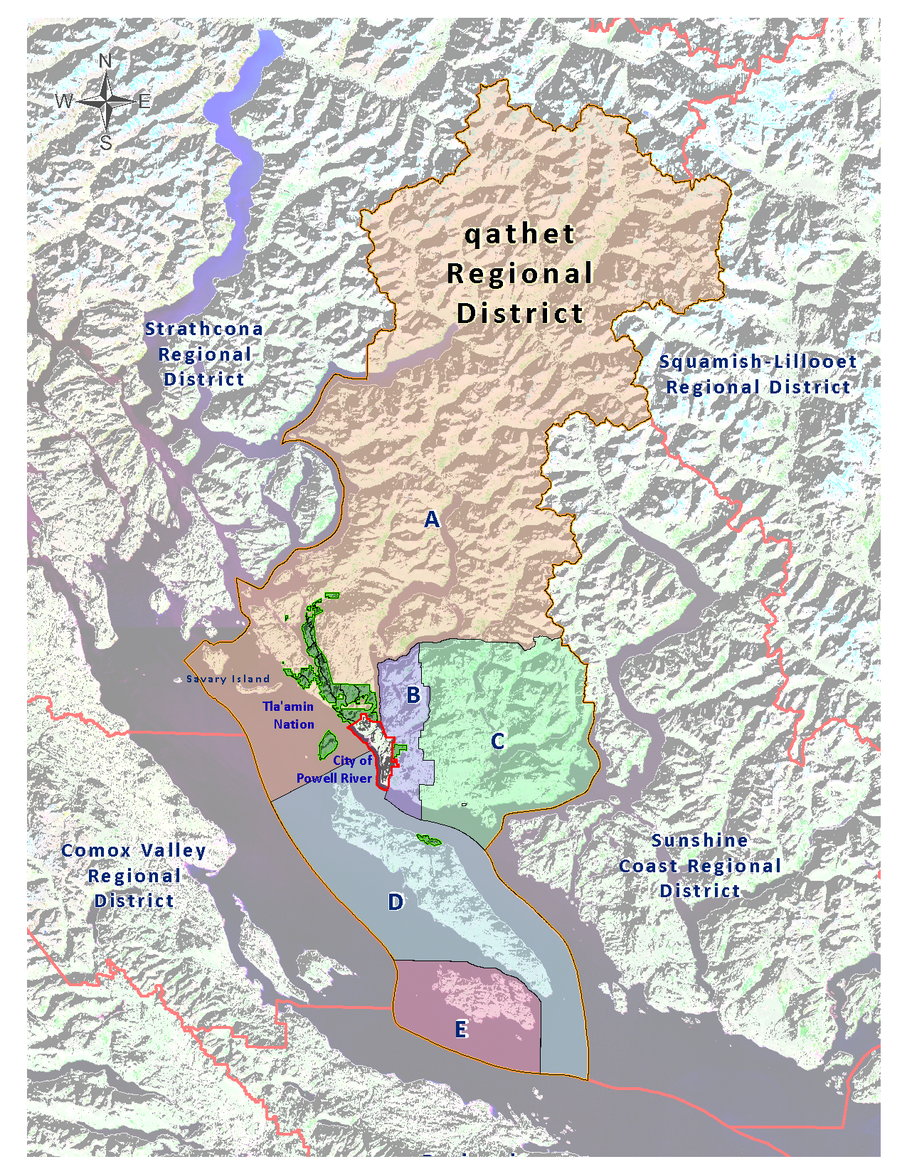
qathet Regional District is a federation whose members include:
- City of Powell River: Covers 17.31 square kilometers and includes the communities of Westview, Cranberry, Wildwood and the original Townsite.
- Area A: Covers the area northwest of the city boundary to Desolation Sound and includes the Malaspina Peninsula, the communities of Lund, Savary and Hernando Islands, and excludes Tla’amin Nation lands.
- Area B: Covers the area southeast of the city boundary to Whalen Road and includes Paradise Valley and properties outside the city on Nootka, Covey and Tanner Streets, and excludes Tla’amin Nation lands.
- Area C: Covers the area southeast from Whalen Road to Jervis Inlet and includes the communities of Black Point, Kelly Creek, Lang Bay, Stillwater and Saltery Bay.
- Area D: Covers all of Texada Island and includes the communities of Blubber Bay, Van Anda and Gillies Bay, and excludes Tla’amin Nation land.
- Area E: Covers all of Lasqueti Island and some small surrounding islands.